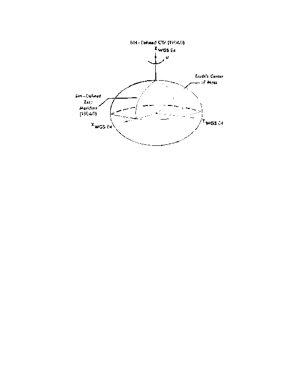
Figure B 1. World Geodetic System 1984 Reference Frame
Z(WGS 84) = Z(NSWC 9Z 2) + 4.5 meters
(2)
S(WGS 84) = S(NSWC 9Z 2) 0.6 ppm
(3)
l(WGS 84) = l(NSWC 9Z 2) + 0.814"
(4)
In the above relationships, Equations 2 4 refer to the Z axis bias, scale correction, and
longitudinal bias in the definition of the prime meridian, respectively, and the WGS 84, thus
achieved, is coincident with the BIH defined CTS
1
.
Origin = Earth s center of mass.
Z Axis = Parallel to the direction of the Conventional Terrestrial Pole (CTP) for
polar motion, as defined by the Bureau International de L Heure (BIH) on the basis
of the coordinates adopted for the BIH stations.
X Axis = Intersection of the WGS 84 Reference Meridian Plane and the plane of
the CTP s Equator, the Reference Meridian being parallel to the Zero Meridian
defined by the BIH on the basis of the coordinates adopted for the BIH stations.
Y Axis = Completes a right handed, ECEF orthogonal coordinate system, measured
in the plane of the CTP Equator, 90 degrees East of the X Axis.
B 2
<< < GO > >>